🔥Save More with Up to 5% OFF
Use our promo code to enjoy up to 5% OFF (up to S$3) on your attraction tickets, tours and eSIMs! Only for new users!

Planning your first trip to Tokyo can feel overwhelming when you look at the map for the first time.
The city is massive, with countless neighbourhoods, train lines, shopping districts, cultural attractions, and day trip destinations spread across the metropolitan area.
For travellers from Singapore, Tokyo feels safe, efficient, and highly organised but unlike Singapore’s compact layout, Tokyo is much larger and more spread out.
Understanding the Tokyo map before your trip helps you choose the right hotel area, reduce travel time, and plan your itinerary more efficiently.
Here’s everything you need to know before visiting.
Tokyo is commonly divided into several major zones that travellers should understand:
Region | What It Includes | Best For |
Central Tokyo | Ginza, Tokyo Station, Marunouchi, Nihonbashi | Business districts, luxury shopping |
West Tokyo | Shinjuku, Shibuya, Harajuku, Nakano | Shopping, nightlife, entertainment |
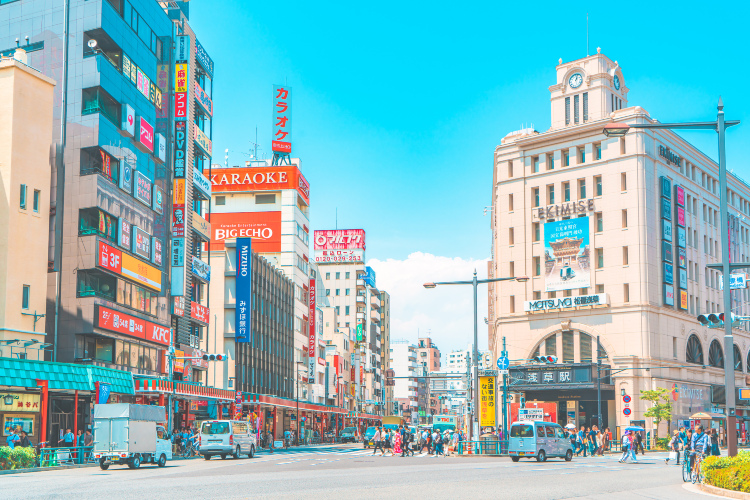
East Tokyo | Asakusa, Ueno, Akihabara, Sumida | Culture, temples, museums |
South Tokyo | Roppongi, Tokyo Tower, Odaiba | Modern attractions, family trips |
Outer Tokyo | Mitaka, Mount Takao, suburban areas | Nature, local experiences |
One of the easiest ways to understand Tokyo’s layout is by using the JR Yamanote Line as your reference point.
Once you understand this loop, navigating Tokyo becomes much easier.
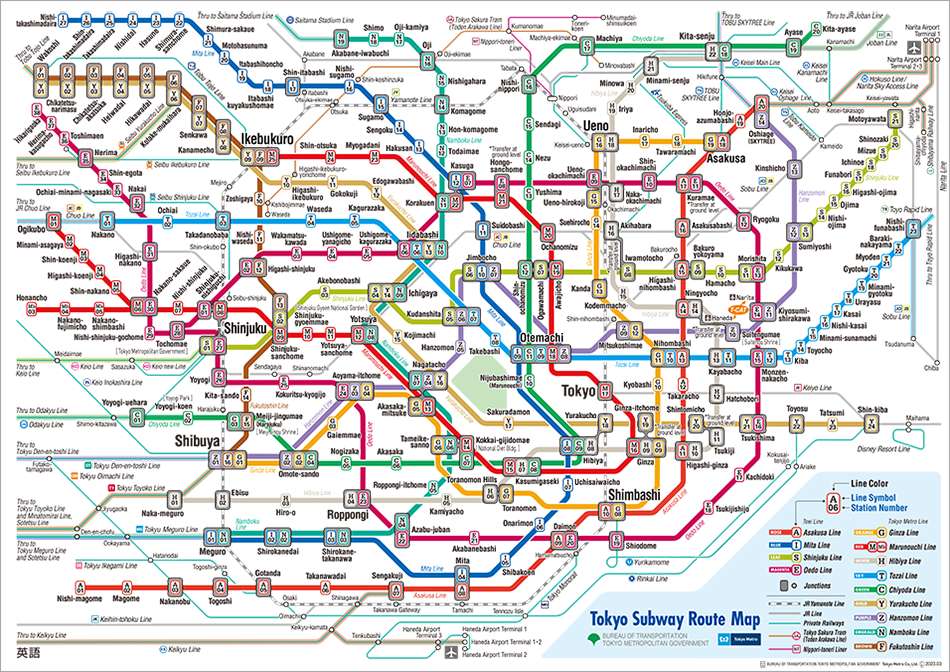
Tokyo’s train network is the easiest way to get around the city.
Line | Colour | Number | Route | Nearby Attractions |
Ginza Line | Orange | Line 3 | Shibuya → Asakusa | Shibuya Crossing, Hachiko Statue, Senso-ji Temple |
Marunouchi Line | Red | Line 4 | Ogikubo → Ikebukuro | Tokyo Dome, Sunshine City, Imperial Palace |
Hibiya Line | Grey | Line 2 | Naka-meguro → Kita-senju | Roppongi Hills, Ebisu Garden Place, Ueno Zoo |
Tozai Line | Blue | Line 5 | Nakano → Nishi-funabashi | Tokyo Skytree, Nihonbashi, Toyosu Market |
Chiyoda Line | Green | Line 9 | Yoyogi-uehara → Kita-ayase | Meiji Shrine, Omotesando, Akihabara |
Yurakucho Line | Khaki | Line 8 | Wakoshi → Shin-kiba | Ginza, Tokyo International Forum, Odaiba |
Hanzomon Line | Purple | Line 11 | Shibuya → Oshiage | Shibuya Scramble, Asakusa, Sumida Aquarium |
Namboku Line | Teal | Line 7 | Meguro → Akabane-iwabuchi | Roppongi, Tokyo Midtown, Sugamo Jizo-dori |
Fukutoshin Line | Brown | Line 13 | Wakoshi → Shibuya | Ikebukuro, Shinjuku, Harajuku |
The JR Yamanote Line is especially useful for first-time Singapore travellers because it connects many major sightseeing districts.
More Info
Tokyo has two major airports:
Transport Option | Travel Time |
Narita Express | Around 55–60 minutes |
Keisei Skyliner | Around 40–50 minutes |
Airport Bus | Around 60–90 minutes |
Transport Option | Travel Time |
Tokyo Monorail | Around 20 minutes |
Keikyu Line | Around 20–30 minutes |
Airport Limousine Bus | Around 30–60 minutes |
Haneda is often more convenient for Singapore travellers due to shorter transfer times.
Other useful transport options include:
Tokyo Taxis
Useful late at night when trains stop operating.
Airport Limousine Buses
Great if travelling with luggage.
Tokyo Water Bus
Scenic route between Asakusa and Odaiba.
Walking
Many areas like Harajuku, Asakusa, and Ginza are best explored on foot.
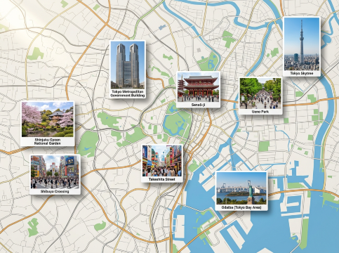
Tokyo offers a mix of modern attractions, historic landmarks and vibrant neighbourhoods.
Shibuya
Shinjuku
Harajuku
Asakusa
Ueno
Odaiba
Tokyo Skytree Area
Address: The Prince Park Tower Tokyo B1F, 4-8-1 Shibakoen, Minato City, Tokyo
Metro Access: About 5 minutes walk from Tokyo Tower / Akabanebashi Station (Toei Oedo Line)
Opening Hours: 11:30 – 15:00, 17:00 – 22:00
What to Try: Freshly fried seasonal tempura, including prawns, seafood, and vegetables served in elegant omakase-style courses with a light and crispy batter.
Address: Tokyo Prince Hotel 1F, 3-3-1 Shibakoen, Minato City, Tokyo
Metro Access: Around 7 minutes walk from Tokyo Tower / Onarimon Station (Toei Mita Line)
Opening Hours:
Weekdays: 11:30 – 14:30, 17:00 – 22:30
Weekends & Public Holidays: 11:30 – 15:00, 17:00 – 22:30
What to Try: A5 Japanese Black Wagyu, rare beef cuts, premium yakiniku platters, and signature grilled beef sets that are perfect for meat lovers after visiting Tokyo Tower.
Address: 4-4-13 Shibakoen, Minato City, Tokyo
Metro Access: About 5 minutes from Tokyo Tower / Akabanebashi Station (Toei Oedo Line)
Opening Hours: 11:00 – 22:00
What to Try: Handmade tofu kaiseki courses, seasonal sashimi, and charcoal-grilled dishes served in a beautiful traditional Japanese garden setting.
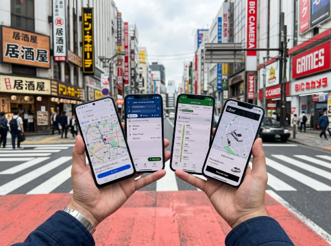
Getting around Tokyo is easy when you have the right apps downloaded before your trip.
App | What It Helps With | Why It’s Useful |
Google Maps | Walking routes and navigation | Best overall navigation tool |
Train planning | Helpful for route transfers | |
JR East App | Train schedules | Useful for JR travellers |
Uber | Private transport | Helpful late at night |
These apps help simplify Tokyo’s large transport network.
If you’re not planning to buy a Japan SIM card or pocket WiFi, downloading offline maps is highly recommended.
Follow these steps:
This is especially useful when arriving at the airport or travelling to suburban areas.
Use our promo code to enjoy up to 5% OFF (up to S$3) on your attraction tickets, tours and eSIMs! Only for new users!
Choosing the right hotel location can save significant travel time.
Area | Why Stay Here | Best For |
Shinjuku | Major transport hub | First-time visitors |
Shibuya | Shopping and nightlife | Young travellers |
Ginza | Luxury shopping | Couples |
Ueno | Budget-friendly hotels | Families |
Convenient transport access | Short trips |
Discover the world with Trip.com! Book the perfect hotel anywhere in the world and get an unbeatable 10% discount if you're a first-time user! Download our app now and start planning your next trip with ease.
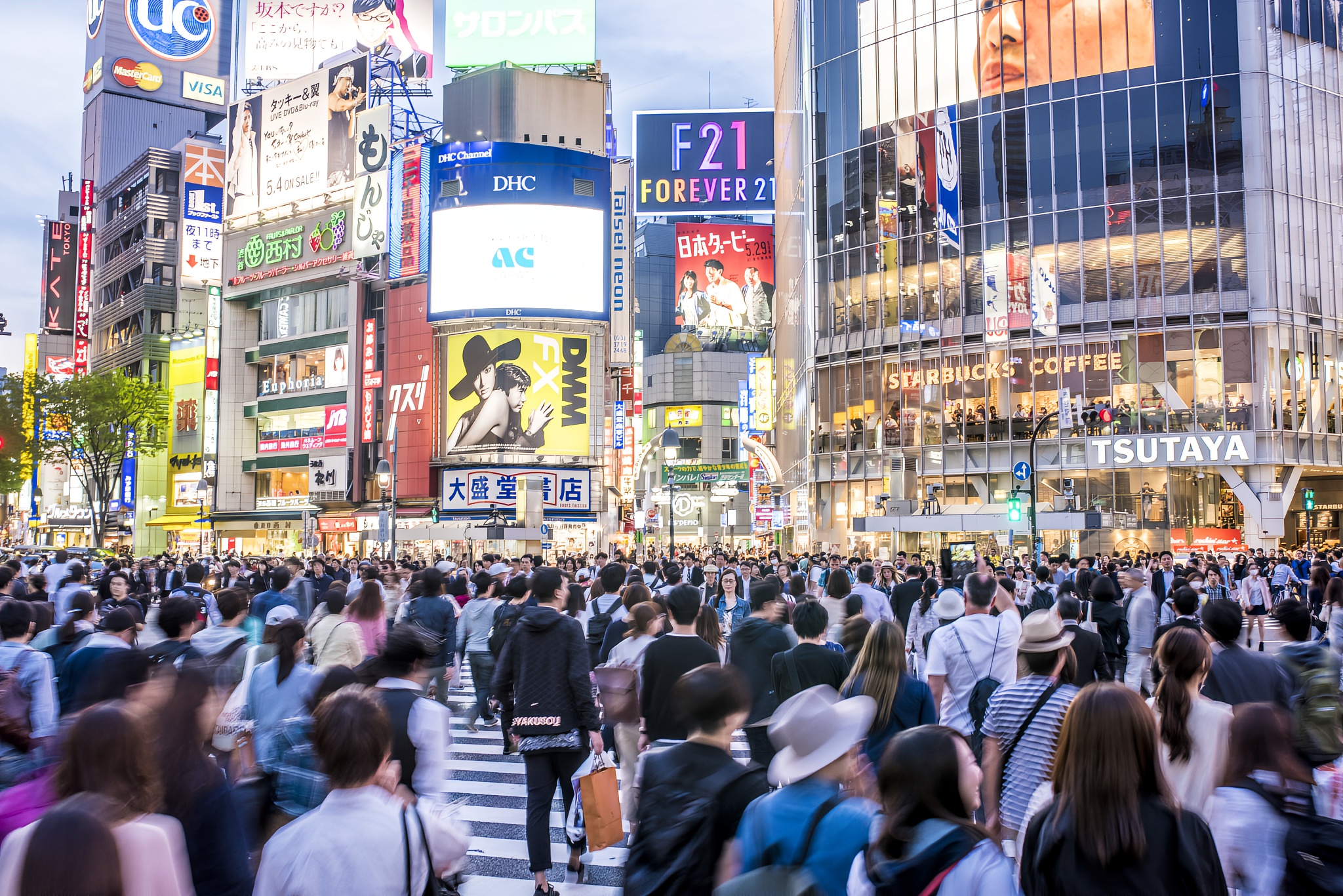
Ideal for Singapore travellers who want to experience Tokyo’s nightlife beyond shopping malls and tourist attractions. Explore the famous Shibuya Crossing before heading into hidden alleyways filled with local izakayas, street food, and authentic nightlife experiences. Great for couples, friends, and food lovers.
Highlights:
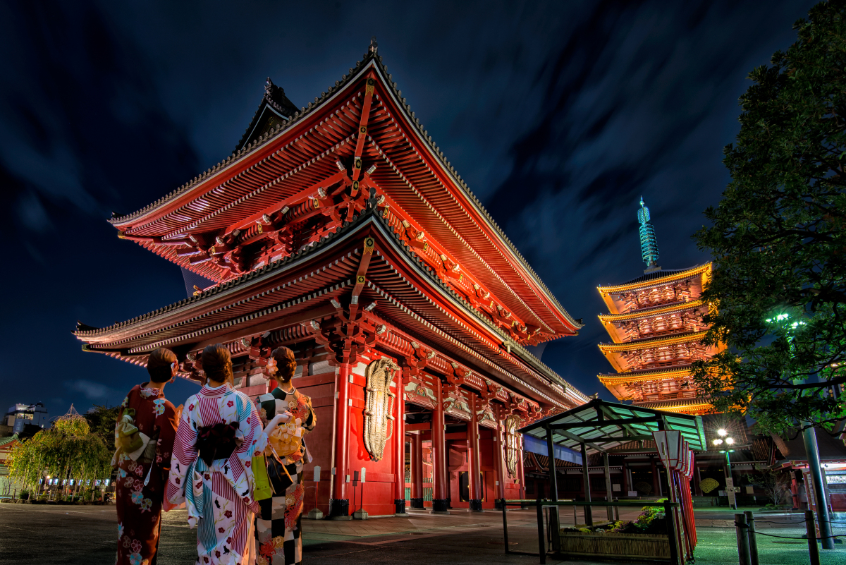
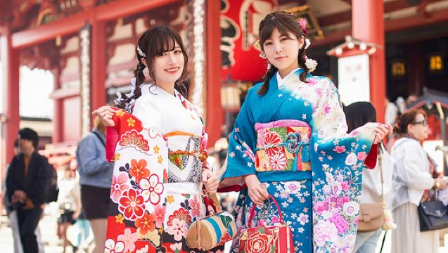
Perfect for first-time Singapore travellers who want to explore Tokyo’s most iconic landmarks in a single day without planning multiple train routes. This tour combines historic temples, famous food spots, city skyline views, and trendy shopping streets, making it ideal for travellers with limited time who want a mix of traditional and modern Tokyo experiences.
Highlights:
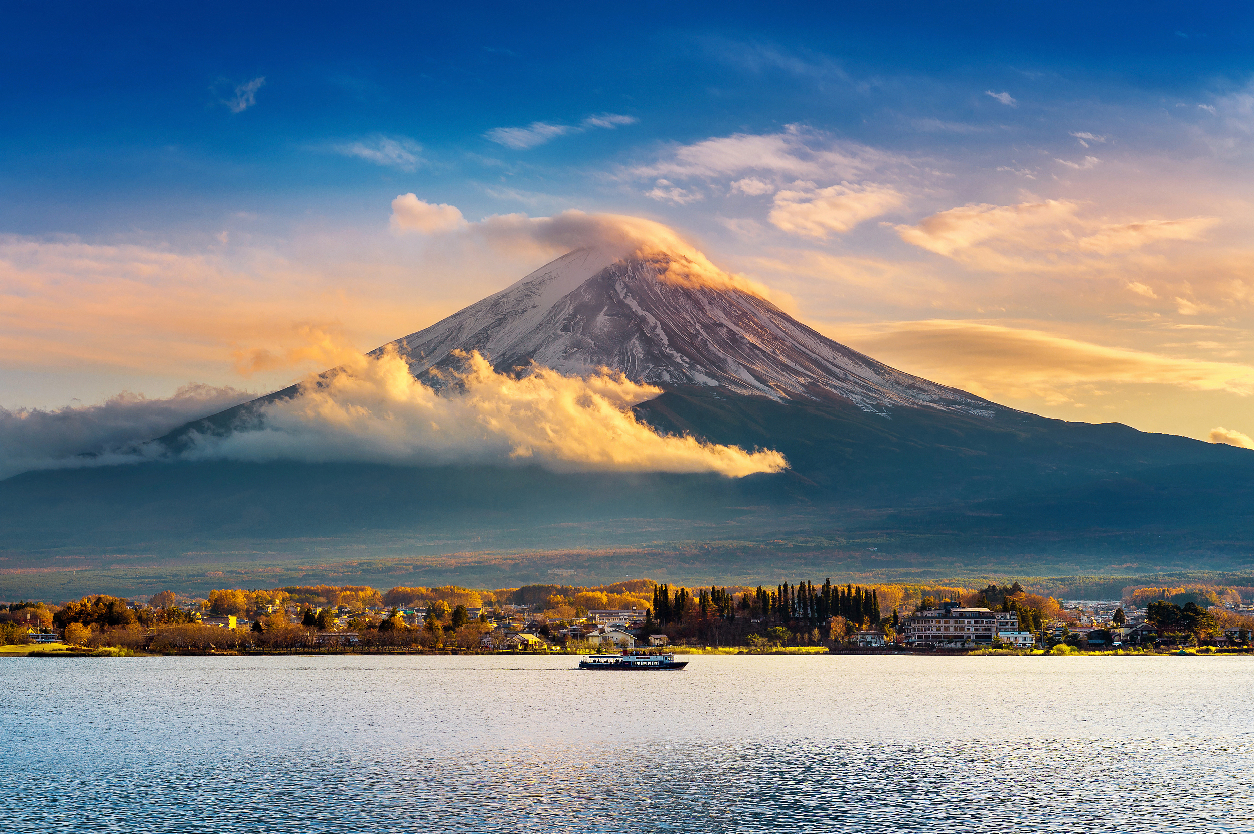
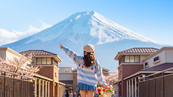
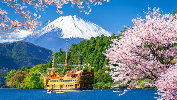
Perfect for Singapore travellers visiting Japan for the first time who want to see Mount Fuji’s most famous photo spots in one convenient day trip. This tour covers popular Instagram locations, seasonal cherry blossom scenery, and picturesque lakeside views without the hassle of planning transportation. Great for travellers who want iconic Fuji photos in a short itinerary.
Highlights:
A Tokyo map may seem complicated at first, but the city becomes much easier to navigate once you understand the major districts and train lines.
For most Singapore travellers, a great Tokyo trip usually includes:
Study the map before your trip, and you’ll spend less time feeling lost and more time enjoying Tokyo.
Read More
 40373 booked
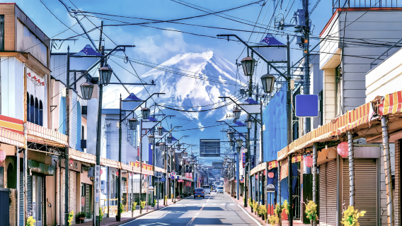

![[Official Ticket] JR Tokyo Wide Area Pass 3-Day (Electronic Redemption Voucher)](https://ak-d.tripcdn.com/images//0586012000rry1wiqCBE8_C_568_320.jpg)
![Skyliner Keisei railway ticket (Tokyo airport express: Narita International Airport-Ueno/Nippori) [optional+Tokyo subway discount package]](https://ak-d.tripcdn.com/images//0580f12000qjpzexo5F36_C_568_320.jpg)