🔥Get 3% Off Your First Train Ticket Booking!
As a special treat, Trip.com is offering a 3% discount on your first train ticket booking. Simply claim your coupon and enjoy a seamless travel experience.
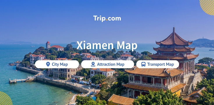
Xiamen is one of those cities where a map changes how you plan your day. The city is an island, its sights are strung along a coastline, and a single ferry ride takes you to a car-free heritage island. Get the geography straight and Xiamen becomes one of the easiest cities in China to explore on your own.
This guide covers the maps that matter: where Xiamen sits, how the airport and rail stations connect to the city, what the metro map means for sightseeing, which sights cluster together on the tourist map, and where to stay so that everything is a short ride away.
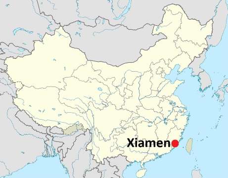
Source: wikimedia
Xiamen (厦门) sits on the south-east coast of China, in Fujian province, facing the Taiwan Strait. On a map of China it is roughly level with the Tropic of Cancer, on the same latitude band as Taipei and just north of Hong Kong.
The important thing about the map is that Xiamen is not one piece of land. The city has six districts, and two of them sit on Xiamen Island itself.
Gulangyu, the car-free island everyone comes for, sits just off the south-west tip of Xiamen Island, a short ferry ride from the cruise terminal.
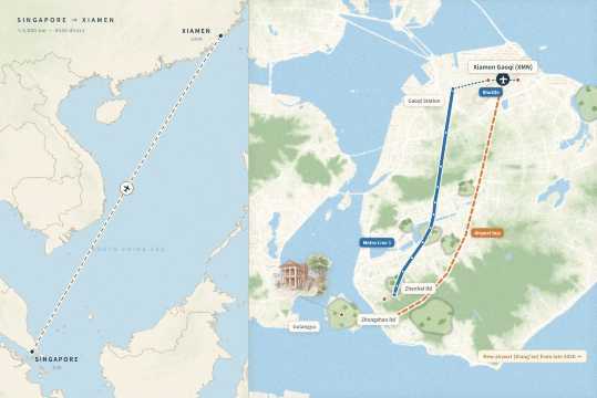
Most Singapore travellers arrive by air. The flight is short by long-haul standards, roughly 3,000 km and about four and a half hours direct, which makes Xiamen a very reasonable long weekend.
Flights land at Xiamen Gaoqi International Airport (XMN), on the northern edge of the island in Huli district, about 10 km from Zhongshan Road. One thing to watch: a new airport at Xiang'an, on the mainland side, is scheduled to take over from Gaoqi around the end of 2026, but the exact date has not been confirmed. Check which airport your booking uses before you arrange transfers.
From the terminal, three options work:
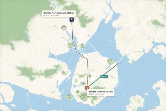
By rail, Xiamen has two main stations and they are not the same place.
As a special treat, Trip.com is offering a 3% discount on your first train ticket booking. Simply claim your coupon and enjoy a seamless travel experience.
Look at a city map and you will see the island as a rounded shape with the old town pressed against its south-western shore. The mainland wraps around the north and west, and the sea sits to the south-east.
Because of that shape, road traffic funnels across a handful of crossings: Xiamen Bridge and Jimei Bridge to the north, Xinglin Bridge and Haicang Bridge to the west, plus the Xiang'an Tunnel and Haicang Tunnel.
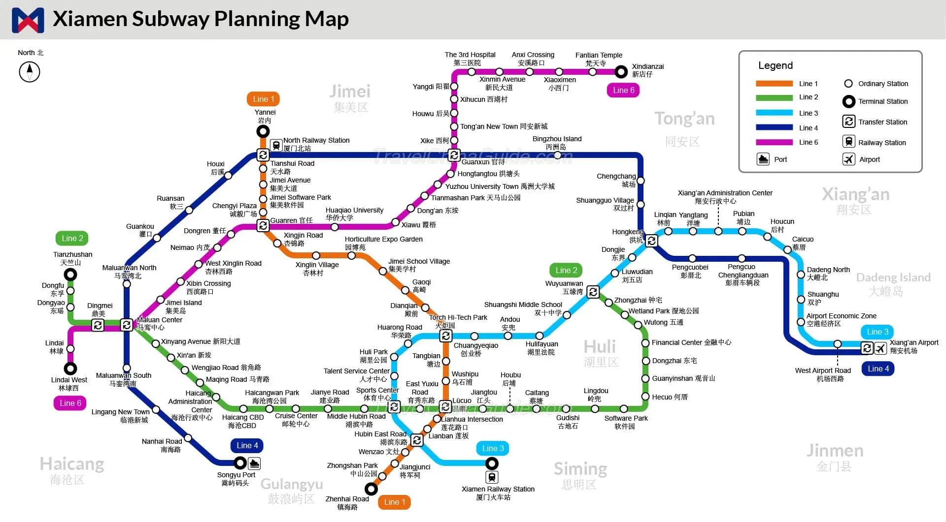
Five metro lines are running: Lines 1, 2, 3, 4 and 6. You will only ever need three of them as a visitor.
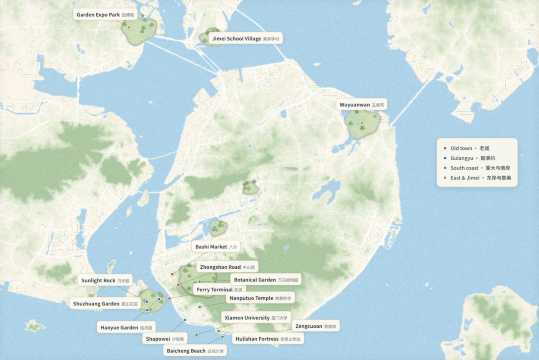
The tourist map divides neatly into four clusters, and the trick is to do one cluster per half day rather than criss-crossing the island.
Cluster | What is there | Getting there | Cost |
Old town | Zhongshan Road, Bashi wet market, ferry area | Line 1 to Zhenhai Road | Free to walk |
Gulangyu | Sunlight Rock, Shuzhuang Garden, Haoyue Garden, piano museums | Line 2 to Cruise Center, then ferry | Ferry S$6.20, island free |
University and south coast | Nanputuo Temple, Xiamen University, Shapowei, Baicheng Beach, Hulishan Fortress | Bus or taxi from Zhenhai Road | Temple free, fortress S$4.45 |
East coast and Jimei | Huandao Road, Zengcuoan, Wuyuanwan, Jimei School Village, Garden Expo Park | Line 1 for Jimei, bus for the coast | Free, park entry varies |
A few details make the map work in practice.
Gulangyu needs planning. Tourists board at the Cruise Center (Xiagu Wharf) during the day, and the standard round trip is ¥35 (about S$6.20). Tickets go on sale 10 days ahead through the official Yujian Xiamen mini program, and you need your passport. The return leg is valid for 20 days. After about 18:00, tourist boats switch to the Lundu terminal opposite Zhongshan Road, which is convenient if you stay on the island for sunset.
The island itself is free to enter, but the five-sight combined ticket costs ¥90 (about S$16).
Xiamen University is free but not casual. Entry runs on a reservation plus lottery system, released three days ahead, so apply before you fly rather than turning up at the gate. Nanputuo Temple next door is also free and takes a timed reservation.
The Botanical Garden, west of the old town, charges ¥30 (about S$5.30) and is worth a half day, especially the rainforest mist section. Inland shuttle tickets cost ¥5 for a single hop or ¥10 for the day, and the park is large enough that the day ticket pays for itself.
Hulishan Fortress, on the coast road, costs ¥25 (about S$4.45) and pairs naturally with Baicheng Beach and Shapowei in one afternoon.
For a half day outside the island, Line 1 reaches Jimei School Village and the Garden Expo Park in about 30 minutes, and both are free to wander.
Use our promo code to enjoy up to 5% OFF (up to S$3) on your attraction tickets, tours and eSIMs! Only for new users!
Buy Cheap eSIM Here
Three areas make sense, and each sits in a different corner of the map.
Area | Best for | Trade-off |
Zhongshan Road and Zhenhai Road | First trips, food, ferry access | Busiest streets, older buildings |
Shapowei and Xiamen University | Couples, cafe culture, photography | Fewer metro stations, more walking |
Huandao Road and Zengcuoan | Sea views, beach mornings | Traffic on weekends, further from the metro |
Gulangyu | One romantic night | Cobblestones with luggage, quiet at night |
For a first visit, staying within walking distance of Zhenhai Road station is the most practical choice. Line 1 puts the airport, Jimei and the old town on one line, and the ferry piers are a short ride or walk away.
Shapowei suits travellers who care more about cafes and sunsets than convenience, while Huandao Road rewards anyone who wants to wake up to the sea, provided you accept taxi rides in the evening.
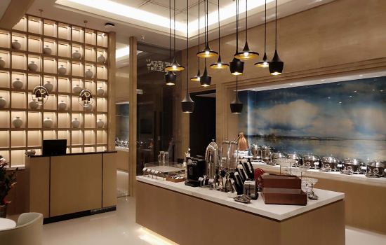
Find Your Stay Now
Read the map as three loops rather than a list of attractions.
 2323088 booked