🔥Get 3% Off Your First Train Ticket Booking!
As a special treat, Trip.com is offering a 3% discount on your first train ticket booking. Simply claim your coupon and enjoy a seamless travel experience.

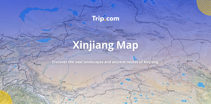
If you are planning a trip to China's most diverse region - that is Xinjiang, you should know a thing or two about it. Xinjiang is really big and covers over 1.66 million kilometres, which is roughly the same size as France, Germany and Spain combined. To help you with your trip to Xinjiang, we have a Xinjiang map guide that shows you the regional divisions, the transportation routes and the major attractions.
Xinjiang Uyghur Autonomous Region is located in the north-west of China next to eight countries like Mongolia, Russia, Kazakhstan, Kyrgyzstan, Tajikistan, Afghanistan, Pakistan and India. On a map of China, it takes up one-sixth of the entire countrys land, which makes it the biggest provincial-level area.
The area has a "three mountains with two basins" shape:
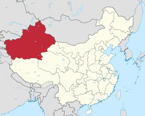
Source: Wikipedia
The land in this area is divide into two parts. You have Northern Xinjiang (Beijiang) and Southern Xinjiang (Nanjiang).
Given Xinjiang's enormous size, understanding your transport options is essential.
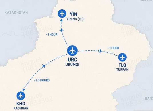
Xinjiang has more than 20 airports that people can use to travel to different parts of the region. If you are coming from Singapore, you will probably fly into Urumqi Tianshan International Airport.
Key Air Routes from Singapore: Singapore to Urumqi takes around 6 to 8 hours. You will have to stop somewhere on the way like Guangzhou, Chengdu or Xi'an.
Major domestic airports in Xinjiang:
Airport | City | Key Routes | Flight Time from Urumqi |
Urumqi Tianshan (URC) | Urumqi | International & domestic hub | — |
Kashgar Airport (KHG) | Kashgar | Southern Xinjiang hub | ~1.5 hours |
Yining Airport (YIN) | Yining (Ili) | Northern Xinjiang | ~1 hour |
Turpan Airport (TLQ) | Turpan | Eastern Xinjiang | ~1 hour |
💡 Pro Tip: For Singaporean travellers short on time, consider "open-jaw" flights, flying into Urumqi and out of Kashgar (or vice versa), to save days of overland travel.
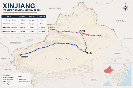
The rail network in Xinjiang has gotten really big with trains that now go to big cities on the northern and southern Silk Road routes.
Route | Distance | Train Type | Duration |
Urumqi → Turpan | ~180 km | High-speed | ~1 hour |
Urumqi → Korla | ~480 km | High-speed | ~3 hours |
Urumqi → Kashgar | ~1,500 km | Express | ~11-14 hours |
Urumqi → Yining | ~680 km | Express | ~5-6 hours |
As a special treat, Trip.com is offering a 3% discount on your first train ticket booking. Simply claim your coupon and enjoy a seamless travel experience.
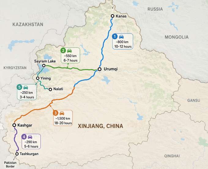
Road travel is where you truly experience Xinjiang's vastness. The region has excellent highways, and self-driving or private car hire is a popular way to explore at your own pace.
Typical driving distances & times:
⚠️ Important: You need to know that some remote areas like Tashkurgan near the Pakistan border need travel permits. So you should check the requirements for travel permits before you go on trip to these remote areas.
Whether you're planning a road trip, a business journey, or just need a reliable ride, now is the perfect time to save. Use the coupon to enjoy this exclusive offer. Rent a car today and hit the road with extra savings!
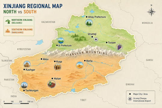
One of the most important things to understand on a Xinjiang tourist map is the division between Northern and Southern Xinjiang, separated by the mighty Tianshan mountain range.
Known for its dramatic natural scenery, Northern Xinjiang is where you'll find snow-capped mountains, turquoise lakes, vast grasslands, and dense forests. It's the most popular region for first-time visitors.
Key Areas:
Southern Xinjiang is the cultural heart of the region, with a strong Uyghur and Central Asian influence. Here you'll find ancient Silk Road cities, bustling bazaars, desert landscapes, and historic mosques.
Key Areas:
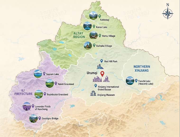
As the regional capital, Urumqi is almost always your starting point. While most travellers pass through quickly, it's worth a day or two to acclimatise and explore.
Top Sights in Urumqi:
Distance from Urumqi:
Located in the far north, the Altay region is Xinjiang's most famous natural beauty spot, often called "Switzerland of the East."
Key Attractions:
Distances from Burqin (the nearest major town):
The Ili Valley in western Xinjiang is known as the "Jiangnan beyond the Great Wall" for its lush greenery, fruit orchards, and Kazakh nomadic culture.
Must-See Sights:
Distances from Yining:
Use our promo code to enjoy up to 5% OFF (up to S$3) on your attraction tickets, tours and eSIMs! Only for new users!
Buy Cheap eSIM Here
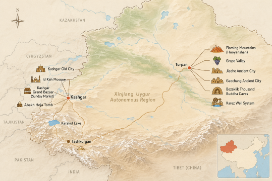
Kashgar is the crown jewel of Southern Xinjiang — a living museum of Silk Road history with a distinctly Central Asian vibe.
Top Attractions in Kashgar:
Distances from Kashgar:
Turpan is a fascinating oasis city in the east, known for its extreme heat, sweet grapes, and ancient history.
Key Sights:
Distances from Turpan City:
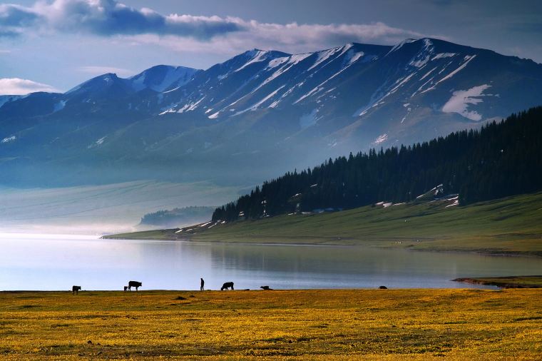
Given Xinjiang's size, most travellers focus on either Northern or Southern Xinjiang in one trip. Here are two classic itineraries mapped out for you.
This is the most popular route for first-time visitors, focusing on natural scenery.
Route: Urumqi → Turpan → Urumqi → Burqin → Kanas → Hemu → Burqin → Sayram Lake → Yining → Nalati → Urumqi
💡 Singaporean Traveller Tip: If you only have 7 days, skip Nalati and fly back from Yining to Urumqi to save time.
Perfect for travellers interested in history, culture, and desert landscapes.
Route: Urumqi → Turpan → Korla → Kuqa → Aksu → Kashgar → Tashkurgan → Kashgar → Fly out
Find Your Stay
 2036594 booked