Things to do in Golog
Explore top experiences
Top 10 attractions in Golog

Amne Machin
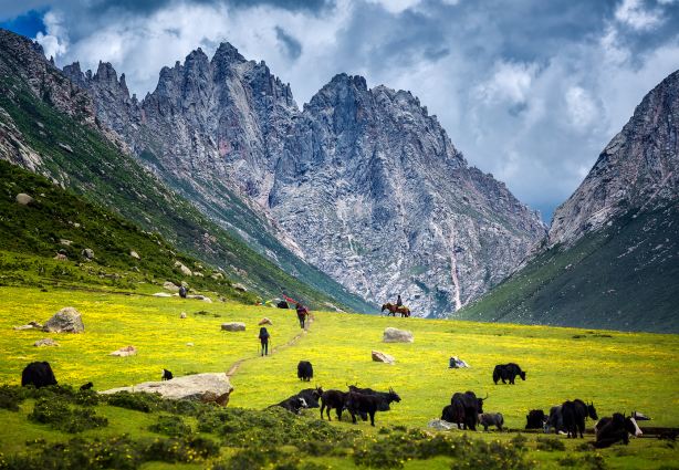
The Amnye Machen Snow Mountain, also known as the Maji Snow Mountain or Maji Gangri, is located in the northwest of Maqin County, Golog Prefecture. The Amnye Machen Mountain is a large mountain at the source of the Yellow River, about 28 kilometers long and 10 kilometers wide. The Yellow River makes a 180-degree turn at the Maji Snow Mountain and flows southeast. The main peak, Maji Gangri, is 6,282 meters above sea level and is regarded as a sacred mountain by Tibetan compatriots. Every year, a large number of pilgrims climb mountains and wade through water, and go to worship devoutly. The Amnye Machen Mountain is majestic and magnificent. The mountain is composed of sandstone, limestone and granite, and consists of 13 peaks. The Harong Glacier on the northeast slope is 7.7 kilometers long, with a vertical height difference of 1,800 meters. It is the largest and longest glacier in the Yellow River Basin. The strange glacier world is in various shapes and is crystal clear. The abundant meltwater from ice and snow gathers into countless trickling streams, winding and interlaced, and lakes of all sizes are shining. It is said that there are many mountain gods in the Anima Snow Mountain. They live in the magnificent nine-story white jade pavilion. Among them, the Animaqing Peak is the largest mountain god. Tibetan compatriots believe in the legend of the Animaqing Mountain. During the worship season, believers come in an endless stream, especially in the Tibetan calendar "Horse Year", when hundreds of thousands of people circumambulate the mountain, because circumambulating the mountain once in the Horse Year is equivalent to 12 circumambulations at ordinary times. When circumambulating the mountain, pilgrims carry simple luggage, cooking utensils and food, brave the wind and rain, wade through mountains and rivers, sleep in the open air, and walk around the mountain with tenacious perseverance to worship for a week. Only then can they express their sincere worship and achieve the purpose of removing sins and sublimating their souls. It usually takes seven or eight days to walk around the mountain on foot, five days on horseback, and more than 60 days to kowtow (prostrate oneself). During the pilgrimage, pilgrims will encounter many strange natural phenomena, such as strange landforms, rugged rocks, unpredictable weather, the sound of clear streams, waterfalls of the Milky Way, various wild animals, etc. All of these seem to be gifts given to them by God. Animaqing is a dreamlike world.Maqin · 79.4km from downtown

Donggetuona Lake Scenic Area
Donggetuona Lake Scenic Area features a beautiful lake with clear water. From the viewing platform, you can see distant snow-capped mountains, and the scenery is quite nice.Madoi · 52.7km from downtown

Yellow River Source Tourist Area
Yellow River Source Tourist Area is located in Madoi County in the heart of Qinghai and is formed by alpine snowmelt from surrounding mountains such as theKunlun MountainandBayankala Mountains. The generally accepted source of the Yellow River currently refers to the area around Gyaring Lake and Ngoring Lake near Mount Bayan Langma, which is also a key destination for visitors to see thesource of the Yellow River. Gyaring Lake and Ngoring Lake are formed by the convergence of alpine snowmelt. Due to their high-altitude, pollution-free location, the lake water is crystal clear and blue, offering stunning scenery. In summer, the grasslands around the lakes turn lush green, and you can often spot Tibetan antelopes. The famousOx-Head Monument at the Source of the Yellow Riveris also located here, making it a must-visit spot for tourists to take photos. It is generally recommended to visit the scenic area in summer, as heavy snow can block roads during other seasons due to the high altitude. Road conditions within the scenic area are poor, and generally, only off-road vehicles can enter.Madoi · 37.4km from downtown

Qinghai Maduo Three-River-Source National Park
Located in the hinterland of the Qinghai-Tibet Plateau, Sanjiangyuan National Park is the source of the Yangtze River, the Yellow River and the Lancang River. The total area is 123,100 square kilometers, involving the four counties of Zhiduo, Qumalai, Maduo and Zaduo and the jurisdiction of the Hoh Xil Nature Reserve, with a total of 12 towns and 53 administrative villages. The region includes the famous Kunlun Mountains, Bayankala Mountains, Tanggula Mountains and other mountains, winding and glaciers towering. The average altitude here is above 4,500 meters, the snowfield is vast, there are many rivers, swamps and lakes, and there are 167 lakes with an area greater than 1 square kilometer. Sanjiangyuan National Park includes three parks: the Yangtze River Source Park, the Yellow River Source Park and the Lancang River Source Park. The Yangtze River source area is famous for its beautiful alpine glaciers; the lakes at the source of the Yellow River are dotted with lakes, presenting a "thousand lakes" spectacle. Eling Lake and Zhaling Lake are like two pearls inlaid in the grasslands of the plateau. The two sides of the canyon at the source of the Lancang River are not only beautiful, but also a paradise for plateau creatures. On October 12, 2021, Sanjiangyuan National Park was included in the first batch of national parks.Madoi · 2.7km from downtown

Xingxinghai Scenic Area
Madoi · 13.9km from downtown

Xiannv Lake Scenic Area
Fairy Lake (Ximencuo) is located in Nianbaoyuze Scenic Area, Jiuzhi County, Guoluo Prefecture, Qinghai Province. Fairy Lake is the first lake you see when you enter from the main entrance of Nianbaoyuze Scenic Spot and walk along the plank road. The road has already extended to Fairy Lake Scenic Spot. The water of Fairy Lake is crystal clear, and the underwater plateau lake fish can be clearly seen. Surrounded by thick fog in the morning and evening every day, it is elegant and quiet. Tibetans often throw agate, silver coins and wind horses in the lake to pray for good luck. There is a huge stone in the southeast of Fairy Lake, with a deep stone mark on it, which leads directly to the lake. It is said that this is the marriage place of the youngest daughter of Nian Baoshan God and the hunter. Therefore, there is a simmering mulberry pool platform under the stone, surrounded by prayer flags. Fluttering, the incense continued.Jigzhi · 37.1km from downtown

Gyaring Lake
After the Yellow River originated from Kariqu and Yoguzongliequ, it passed through the Xingsu Sea and was blocked by Bayanlangma Mountain and Cuoerduoze Mountain, forming the first huge lake at the source of the Yellow River - Zhaling Lake. "Zhaling" is Mongolian, meaning "grey-white long lake", and it was called "Bohai" in ancient times. Zhaling Lake is long from east to west and narrow from north to south. It resembles a beautiful large shell embedded in the Yellow River. The lake covers an area of 526 square kilometers and has an average water depth of about 9 meters. The water of Zhaling Lake is clear and bright, and the south of the center of the lake is the main line of the Yellow River. It looks like a wide creamy yellow belt that divides the lake into two halves, one half of which is clear and green, and the other half is slightly whitish. Hence the name "White Long Lake". At the southwest corner of Zhaling Lake, not far from where the Yellow River enters the lake, there are three small islands with an area of 1 to 2 square kilometers. There are a large number of waterfowl inhabiting the islands, so it is also called "Bird Island". Most of the birds here are migratory birds. Every spring, tens of thousands of geese, fish and other birds fly here from the Indian peninsula to thrive.Madoi · 78.7km from downtown

Ragya Monastery
Lajia Temple is located at the foot of Aniqungong Mountain, Lajia Township, on the north bank of the Yellow River in Maqin County, Qinghai Province. It is located in a canyon, with low altitude, humid climate, mostly fertile fields along the coast, and beautiful and charming natural scenery. Lajia Temple, also known as "Jiaxiang Temple", is a very famous Gelug monastery along the Yellow River. "Laga" is a Tibetan transliteration, referring to the four dislikes, that is, the elk. It is said that when Raja Monastery broke ground, a four-looking elephant was found, so the monastery took its name from it. The monastery was founded by Arou Geshe and is a monastery of Sera Monastery. The main Buddha statues enshrined in the temple are Sakyamuni, Tsongkhapa, Padmasambhava, Thousand Eyes and Thousand Hands Avalokitesvara, Longevity Buddha, Six Arms Anti-Dharma Protection and so on. The architecture of the temple has both the characteristics of Tibetan Buddhist monasteries and the architectural style of Han monasteries. The whole temple building forms a small building complex, similar to the architectural style of the classical gardens in the Central Plains. The whole monastery is surrounded by mountains and rivers, and the terrain is beautiful. Backed by the verdant pines and cypresses of Amenilegong Mountain, the scenery is very pleasant under the flowing silk-like streams. The monastery has a large scripture hall "Tuosanglin", which is in charge of the whole monastery. There is also a Bodhi Pagoda. Among them, the Shakyamuni Hall was built in the Qianlong era and has a very long history. There have been many eminent monks in the temple in the past dynasties, and many writings have been handed down. Among them, Xihe Zuosangre's "Summary of Calendar", Xiangsa's "Theory of Demonstration", "Theory of Cause" and "Complete Works of Saikangwa" have considerable influence in Tibetan areas. The sutra printing house of the monastery once kept more than 50,000 pieces of Muhai steamed buns such as "Ganzhuer".Maqin · 44.8km from downtown

Nianbaoyuze National Geopark
Nianbaoyu is located in Jiuzhi County, Guoluo Prefecture, Qinghai. The main peak is 5,396 meters above sea level. There are many lakes under the mountain in Nianbaoyu, and in summer there are five-color meadows full of flowers. The beautiful scenery against the snow-capped mountains, lakes and sea of flowers is a paradise in the minds of many photographers. It is very good to come here for sightseeing and taking pictures. . In addition, there is a vast area around the mountain, most of which are undeveloped and primitive scenery. Camps can be camped in the scenic area. Many outdoor enthusiasts also regard it as a high-quality hiking trail. The gate of Nianbao Yuze Scenic Spot is located on the north side, close to the S101 provincial road. Generally, tourists will come from Jiuzhi County or Dari County. The classic way to play Nianbaoyu is to start from Xining, combine the famous Qinghai Lake in Qinghai and the Langmusi and Labrang Temple in Gansu and Gannan to take a seven-day loop. In Nianbaoyu, the landscape in the scenic area is primitive, and vehicles cannot enter. The way of play is on foot or horseback. In Nianbaoyu, a regular tour takes 1-2 days, and some outdoor enthusiasts will choose to walk through the entire large scenic spot, which takes about 4 days. The suitable season to play Nianbaoyu is July and August every year. Other times are too cold and the landscape will be discounted. The well-known landscapes in the scenic area are the Fairy Lake, the main peak of the annual security and the Yaonv Lake. It is a classic and conventional way for tourists to stay near Fairy Lake after arriving at the scenic spot on the first day, and walk or ride horses from Fairy Lake to Demon Lake on the second day. Fairy Lake is near the entrance of the scenic spot. Behind the lake is the main peak. The scenery here is also particularly beautiful. There is a clear lake in the depths of the open sea of flowers, and behind the lake is the beautiful main peak of annual insurance. The scenery here in the morning is even more fantastic. The mountains behind are often surrounded by a long strip of morning fog, which is a favorite picture of photographers, so everyone camps and stays here. The Demon Lake is located a little deeper in the mountains. The lake here is green and the scenery is very beautiful. Fairy Lake is close to the entrance of the scenic spot. There are about a dozen kilometers of road between the Lake and the Demon Lake. It takes about 4 hours for one-way walking, about 2.5 hours for horseback riding, and about 100 yuan for each horse round trip. In addition to the Fairy Lake and the Demon Lake, there are many lakes in the depths of the scenic area that are not known to most people, with a total of more than 300 lakes, among which the larger ones are Riga Macuo, Marza Lake, Maridang Lake and so on. In addition, the deep passes and stone forests are also more primitive and beautiful. Therefore, many outdoor enthusiasts will choose to hike through the depths. It takes about 4 days to walk through the entire scenic spot. You can ask a local person as a guide for about 150 yuan per day. During the hike, you can camp and stay in the vicinity of Xiarigancuo, Yakouxia and Algacuo, among them, there will occasionally be Tibetan herdsmen's homes to live in in the summer of Xiarigancuo, about 50 yuan per person. It should be noted that the supplies on this road need to be brought in by yourself, and the altitude here is high and the line is very long. It is only suitable for friends with outdoor experience, not for ordinary tourists. Accommodation and dining 1. At the gate of the scenic spot (that is, near the Fairy Lake), there are some tin houses of local Tibetan residents that can live in, basically multi-person rooms, about 50 yuan per person, cannot take a bath, and it will be cold at night (even in summer nights Wear thick coats and other clothing), bring enough thick clothing, and cover your body with a quilt at night. 2. ItJigzhi · 48.3km from downtown

Nianbao Yuze Glacier Viewing Point
Jigzhi · 35.8km from downtown
Experiences you can't miss in Golog
Featured Travel photography in Golog
View all Travel photography
FromS$ 21.30

5.0/5
· 2 reviewsInstant confirmation
Book now for today
FromS$ 21.30

FromS$ 42.59

FromS$ 138.41

FromS$ 42.59

FromS$ 138.41

FromS$ 138.41

Free things to do in Golog


What travellers say about Golog

印象西南29 July 2026
4.0
Driving along the Dema Expressway to Golog, we finally saw one of the four sacred mountains of Tibet—Mount Amne Machin. Unlike other famous snow-capped mountains heavily commercialized, this place retains a rare pristine tranquility. There are no crowds of tourists, only grasslands, prayer flags, and continuous snow-capped peaks, perfect for travelers who want to quietly appreciate the magnificent scenery of the plateau.
The viewing platform next to the No. 1 Tunnel of the snow mountain offers an excellent free photo opportunity. On a clear day, the main peak of Amne Machin Kangri is fully revealed, with several glaciers cascading down the mountainside, their grey-white ice tongues stretching into the valleys. Below lies an endless alpine meadow, where yaks graze leisurely, and colorful prayer flags flutter in the wind—every snapshot is an atmospheric scene. If you're lucky enough to arrive at dawn, the sunlight bathes the snow-capped peaks, creating a breathtaking golden sunrise.
If you want to get closer to the glacier, you can exit the expressway and head towards Damxung Glacier. However, please note that after leaving the main road, the road surface is mostly unpaved gravel with many curves, and it can easily become muddy in rainy weather, so drive with caution. Reaching the foot of the glacier requires a short hike. The area's altitude is generally above 4300 meters, so avoid running or fast walking, as this can easily trigger altitude sickness. Standing beneath the millennia-old glacier, you can clearly see crevasses and deep blue ice layers, hear the howling wind, and truly feel the immense power of nature.
Let's discuss some objective challenges to the trip, which you should consider beforehand. The weather on the plateau is unpredictable; one moment it's clear and sunny, the next it can be shrouded in clouds, obscuring the entire snow-capped mountain and making it easy to miss your destination. Always check the weather forecast beforehand. Cell phone signal is intermittent in the heart of the region, so it's recommended to download offline maps beforehand. Amenities are very basic; there are few shops and restrooms along the way, so bring your own drinking water and snacks. Drones are strictly prohibited throughout the area; don't waste your trip.
As a sacred pilgrimage mountain for Tibetans, please respect local customs. Circumambulate the mani stones clockwise, do not trample or damage prayer flags, and take all trash with you. There's no need to insist on reaching the depths of the glacier; a distant view of the sacred mountain from the highway observation deck is just as moving.
More than a rushed sightseeing tour, Amne Machin is best experienced at a leisurely pace. Here, all the anxieties of city life will find peace before the majestic snow-capped mountains. Those who prefer off-the-beaten-path destinations and pristine highland scenery should definitely come; however, tourists seeking well-equipped and comfortable facilities should consider carefully.
Amne Machin

M29***5112 May 2025
5.0
位于青海省玛多县花石峡镇西北约16公里处,地处海拔4117米的高原盆地,被布青山、布尔汗布达山等环绕。藏语名“冬格措纳”意为“一千座山围成的湖”,蒙语称“托索湖”或“黑海”,因湖水深蓝如墨而得名。冬格那措湖冬季呈现“半湖碧水半湖冰”的奇观,夏季湖周草甸与红草滩交织,色彩斑斓。
Donggetuona Lake Scenic Area

kongyaoji20 January 2022
5.0
I came to Maduo County in the hinterland of Qinghai just for the two lakes and one monument, the source of the Yellow River - Eling Lake and Zhaling Lake near Bayan Langma Mountain. These two plateau lakes were formed by the snow water from the surrounding mountains such as Kunlun Mountain and Bayankala Mountain. The source of the Yellow River in the common sense refers to here. Because it is located on a plateau without pollution, the lake water is clear and blue, the grassland beside the lake is green, and climbing to the top of the mountain where the Niutou Monument is located is like walking in the clouds, with an intoxicating scene of sky light and cloud shadows wandering together. It's a pity that the wind on the top of the mountain is too strong, and the altitude is 4610 meters, which makes my head hurt, so I can only pass by in a hurry.
Yellow River Source Tourist Area

躺平的圆脸葡萄4 December 2024
5.0
Title: [Highland Secret] Sanjiangyuan National Park, explore the miracle of nature🏞️💧
Text:
Dear friends, today I will take you to Sanjiangyuan National Park in Qinghai Province to explore this magical plateau wetland and feel the magnificence of nature and the vitality of life.
🌄[First impression of Sanjiangyuan]
Sanjiangyuan National Park, located in the hinterland of the Qinghai-Tibet Plateau, is the source of the three major rivers of the Yangtze River, the Yellow River and the Lancang River. It is known as the "Chinese Water Tower" and is an important ecological barrier in China and even Asia.
🌿[Plateau Wetland]
We strolled on the wetlands of Sanjiangyuan, feeling the fresh air and boundless greenery. The wetland ecosystem here is well preserved and is the habitat of many rare animals and plants.
🐉[Exploring the Water Source]
The charm of Sanjiangyuan lies in its water source. We followed the clear streams to find the source of the Yangtze River, the Yellow River and the Lancang River, and felt the sacredness and greatness of the source of life.
🚶♂️【Hiking Experience】
Hiking is a great way to experience Sanjiangyuan National Park. We crossed grasslands, wetlands and snow-capped mountains, and every step was full of the fun of adventure and awe of nature.
🌅【Sunrise and Sunset】
In Sanjiangyuan, sunrise and sunset are both beautiful views that cannot be missed. We chose a suitable location and quietly waited for the sun to rise and set from the horizon, feeling the flow of time and the tranquility of nature.
📸【Photography and Check-in】
Every corner of Sanjiangyuan is a good place to take pictures. From the magnificence of snow-capped mountains to the softness of wetlands, from the vastness of grasslands to the clarity of streams, every frame is a masterpiece of nature.
📝【Strategy Suggestions】
• The Sanjiangyuan area has a high altitude. It is recommended to prepare for plateau adaptation in advance, pay attention to sun protection and keep warm.
• Due to the importance of ecological protection, please abide by the park regulations when visiting, do not destroy vegetation and disturb wild animals.
• Bring enough water and food, because there are fewer supply points in the park.
• Choose the right season to visit. Summer and autumn are the most beautiful seasons in Sanjiangyuan.
Qinghai Maduo Three-River-Source National Park

M29***625 May 2020
5.0
Zhaling Lake is a large freshwater lake in the upper reaches of the Yellow River. It is also called "Chalinghai". It means "white long lake" in Tibetan. It is located in the western tectonic depression of Maduo County, Qinghai Plateau, to the west of Eling Lake. Zhaling Lake and Eling Lake are the largest pair of freshwater lakes in the upper reaches of the Yellow River. They are also called "Chalinghai", which means "white long lake" in Tibetan.
Gyaring Lake

小旅的各地游记本30 June 2025
5.0
✅ The 600-year-old Gelugpa temple hidden in the arms of the Yellow River, a divine location with red walls and golden roofs and snow-capped mountains and grasslands
✅ The back mountain overlooks the panoramic view of the "First Bay of the Yellow River", and the visual attack of the Jinguangman Temple at sunset
✅ Feel the warmth of Tibetan faith up close: the sound of prayer wheels turning, monks chanting, and believers praying for blessings in a vivid humanistic scene
Ragya Monastery

铁军包车俱乐部3 May 2016
5.0
Nianbaoyu is a sacred mountain in Goluo grassland of Qinghai Province, with its main peak at 5369 meters above sea level. The mystery of Nianbao Yuze is that the unpredictable weather, July and August, will also experience the changes of spring, summer, autumn and winter. In the early morning, the sky was full of stars, but there were heavy snow falling, cold, like a winter scene, a red sun rising from the east, the whole mountain was filled with thick fog, and soon the golden sunshine spread all over the earth, blue sky. In the morning, the mountains became dense and rained cats and dogs; at noon, the clouds opened and fog dispersed and the sun was hot, returning to the hot summer season of midsummer; in the afternoon, there was a sudden gust of wind, thunder and lightning, and hail fell from the sky; in the evening, the sunset set set, the grassland completely restored its former tranquility, while Nian Baoyu uncovered its mysterious veil, Tingting Yuli, graceful and graceful. She was kind, peaceful and graceful. A kind face was shown to the people again. Shenshan Nianbao Jade Principle is famous for its mountainous peaks, snow ridges with silver, thunder in severe winter, snow in midsummer, wind and rocks, and moon stars.
Nianbaoyuze National Geopark


