[Newest] This month's promo code pack
OverviewNearbyReviewsWin PrizesRecommended
Share to
Sada Pass
佐田岬1.9
 based on 61 reviews
Address:
Shono, 796-0823, JapanMap
What travelers say:

See all 5 photos
Recommendations Near Sada Pass
Sada Pass Reviews: Insider Insights and Visitor Experiences
Write a Review
 Trip.com
 (61 Reviews)TripAdvisor61 Reviews
You Might Also Like
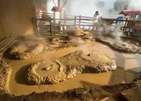
Beppu "Jigoku Meguri" Hells Tour
5.9
4.6/5275 Reviews
From S$ 18.59
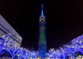
Fukuoka Tower
6.6
4.5/5611 Reviews
From S$ 6.76
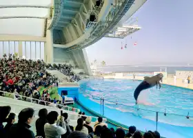
Marine World
6.1
4.6/5166 Reviews
From S$ 21.13

Huis Ten Bosch
6.2
4.6/5326 Reviews
From S$ 47.32
Nearby Attractions
Ikata Town Health Interaction Hall - Kamega Pond Hot Spring | Shimonada Station | Ao Island | Oku Observatory | Red Wing Park | Ozu Castle | Moon Beach Inoura Camping Ground | Murohana Park | Futami Kururin wind hill park. | Garyu Sanso | Uchiko-za | Sadamisaki Peninsula | Yawatahama Kuroyu Onsen | Ehime Prefecture Museum of History and Culture | Butsumokuji Temple | Kamega Pond Park Camping Ground. | Nationally designated natural monument.The Moraceae tree in Misaki. | Ikata Service Inc.Ikata Sports Center. | Kamihaga Residence | Garyunoyu | Moon Beach in Inoura. | Shikoku Electric Power CO.,Inc.Ikata Visitor's House. | Machimi Folk Museum | Nagahama Large Bridge. | Shussekiji Temple | Mt.Tomisu Park. | Hijikawa Arashi Overlook | Kawanohama Park | Ehime Golf Club | Uwa Rice Museum
Popular Types of Attractions in Ikata
Parks | City Parks | Botanical Gardens | Zoos | Religious Sites | Other Places of Worship | Temples | Churches and Cathedrals | Exhibition Centers | Museums | Art Museums | Art Galleries | Architecture & Landmarks | Monuments | Observation Decks | landmark | Lifestyle | Hot Springs | Resorts | Entertainment Centers | Historic Sites | Historical Sites | Castles | Cemeteries | Popular Spots | Nature | Attractions | Mountains | Lakes | Fitness
Popular Destinations
Quebec City Travel | Tawau Travel | Xi'an Travel | Pattaya Travel | Sichuan Travel | Burqin Travel | Suzhou Travel | Dongguan Travel | Yichang Travel | Lombok Travel | Shantou Travel | Krabi Travel | Putian Travel | Solo Travel | Nikko Travel | Takasaki Travel | Tangier Travel | Vienna Travel | Hailin Travel | Talbot County Travel | Newport Travel | Ajax Travel | Hita Travel | Riviera Suisse Travel | Sumter County Travel | Beja District Travel | Dongyuan Travel | Wuppertal Travel | Sheridan Travel | Berkeley Travel
Recommended Attractions at Popular Destinations
Bangkok attraction near me | Manila attraction near me | Tokyo attraction near me | Taipei attraction near me | Hong Kong attraction near me | Seoul attraction near me | Los Angeles attraction near me | Kuala Lumpur attraction near me | Shanghai attraction near me | New York attraction near me | Shenzhen attraction near me | Osaka attraction near me | London attraction near me | Singapore attraction near me | Guangzhou attraction near me | San Francisco attraction near me | Beijing attraction near me | Macau attraction near me | Bali attraction near me | Paris attraction near me | Jakarta attraction near me | Ho Chi Minh City attraction near me | Orlando attraction near me | Phuket attraction near me | Toronto attraction near me | Chicago attraction near me | Cebu attraction near me | Seattle attraction near me | Istanbul attraction near me | Fukuoka attraction near me
Popular Ranked Lists
Popular Family-friendly Attractions Near Fuzhou | Popular Family-friendly Attractions Near Wenshan | Top 3 Premium Hotels in Changzhi | Popular Luxury Hotels Near Thulusdhoo | Top 17 Local Restaurants in Auckland | Top 10 Local Restaurants in Geneva | Popular Luxury Hotels Near College Station | Popular Family-friendly Attractions Near Zixi | Top 9 Local Restaurants in Wellington | Top 19 Local Restaurants in Da Nang | Popular Family-friendly Attractions Near Zhouning | Popular Family-friendly Attractions Near Yicheng | Top 12 Local Restaurants in Nha Trang | Popular Family-friendly Attractions Near Luyi | Popular Luxury Hotels Near Steamboat Springs | Popular Luxury Hotels Near Quanzhou | Top 18 Local Restaurants in Kyoto | Popular Family-friendly Attractions Near Longnan | Top 21 Local Restaurants in Wuxi | Popular Luxury Hotels Near Zurich | Top 25 Local Restaurants in Chengdu | Popular Family-friendly Attractions Near Suixi | Top 4 Bars in Mianyang | Top 20 Local Restaurants in Prague | Popular Family-friendly Attractions Near Zhengyang | Top 4 Bars in Zibo | Popular Luxury Hotels Near Solidaridad | Top 18 Local Restaurants in Jingdezhen | Top 18 Local Restaurants in Oslo
More Things To Do in Ikata
Japan eSIM | SoftBank/IIJmio Unlimited 4G High Speed data(Natural day) | Global (66 Countries) eSIM Data Package (QR Code) | Asia・Australia eSIM|AIS SIM2Fly 8 days 6GB High-speed Unlimited 5G/4G Data | Japan eSIM | SoftBank Unlimited 4G High Speed Data (1 day = 24 hours) | Trip.SIM Japan, South Korea, Macau, Taiwan and many places in Asia + Australia and New Zealand 4G travel data roaming phone network card 4 days/7 days | Japan eSIM | SoftBank Unlimited 5G high-speed data | JR PASS Japan Hiroshima & Yamaguchi/Okayama & Hiroshima & Yamaguchi area 5-day rail pass (electronic ticket) | Japan Fukuoka + Beppu Hell Day Tour [Summer Limited Nyorinji Wind Chime Festival + Yufuin Kinrin Lake] | Global multi-region A series eSIM|High-speed data, travel and business Internet access, optional unlimited data, optional days, QR code | AIS Global eSIM data package (QR code) | Japan eSIM|High-speed data for tourism and business Internet access, unlimited data, optional days, QR code | Yufuin no Mori Sightseeing Train Ticket Booking Service | 【Japan eSIM】Japan eSIM with Unlimited High-speed Data | Global Regions eSIM|Unlimited 4G High Speed Data | AIS SIM2Fly Global eSIM|15 days 6GB high-speed 4G/5G Unlimited Data | China, Hong Kong, Taiwan, Japan, Korea and Thailand Internet and roaming service SIM card| No deposit required | Automatic activation | Stored value card | Prepaid card | [Japan] 4G Docomo | Daily data package | 24H billing | 3-30 days | Uninterrupted network, hotspot sharing support | eSIM QR code | Japan eSIM high-speed traffic, travel and business Internet, days optional softbank network QR code | An Amazing set of Cultural experience: Kimono, Tea Ceremony and Calligraphy | Witness an Oyster Harvest & Interact with Local Oyster Farmers! | Japan Kyushu Natural Animal Park one-day tour[Yufuin/Kinrin Lake/Sea Hell/Hell of the Hearth/Chinese and English Guide/ meeting point Pickup] | Miyajima Half-day Trip Historical Walking Tour | Kyushu Beppu Suginoi Onsen Tour | eSender - Japan eSIM daily package/data package (QR code) | Hiroshima and Miyajima 1 Day Walking Tour | Make your own kitchen knife with a master blacksmith in Shimanto | Private Full Day Hiroshima Tour | Hiroshima Departure - 1 Day Hiroshima & Miyajima Tour | AIS Asia eSIM data package (QR code) | [Town walk] Stroll around Matsuyama Castle and enjoy local shopping
Payment Methods
Our Partners
Copyright © 2024 Trip.com Travel Singapore Pte. Ltd. All rights reserved
Site Operator: Trip.com Travel Singapore Pte. Ltd. Travel License No. 02943
Site Operator: Trip.com Travel Singapore Pte. Ltd. Travel License No. 02943
Stunning view.
You can even see Kyushu island when it is fine. Cape Sada is the slimmest and longest cape in Japan.
Stunning view.
You can even see Kyushu island when it is fine. Cape Sada is the slimmest and longest cape in Japan.
The westernmost end of Shikoku. The lighthouse is not on the edge but on the other side. I walk from the parking lot.
About 40 minutes from Misaki Port, you will arrive at Cape Sada by walking for about 30 minutes one way from the parking lot that has ups and downs and follows a narrow road on the way. The road from the parking lot is also up and down, and easy-to-walk shoes are essential. When you reach the lighthouse, it is the tip of the main island of Shikoku, but since there is an island called Mikago Island and a fishing facility was built between the mainland, the island is connected to land. Cape SATA was once made for the war called Toyoyo fortress ...
Westernmost of the four countries
About 50km from Yawatahama. I was prepared for a certain time, but due to the Ikata nuclear power plant on the way, the road is in better condition than expected and you can reach the cape in about an hour. Beyond the strait is Sekizaki in Kyushu. As famous for Seki Saba Seki Aji, the tide flows fast and beautiful. People who see the map want to build a bridge here, but I think it will be very difficult to actually see it.